Maps
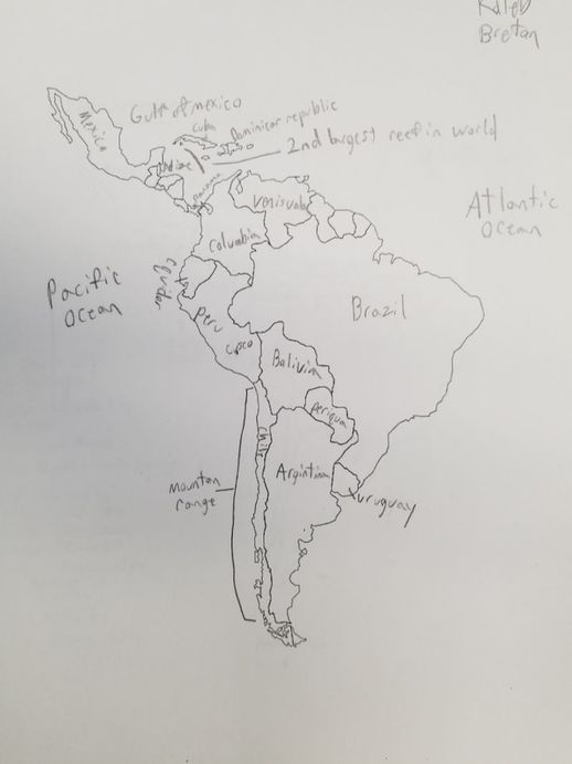
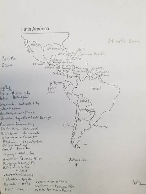
These maps are currently works in progress, the first map (on the left) below shows my first draft, and each one (left to right) below that shows another draft. They include country names, capitals, and bodies of water.
|
|
Overveiw
The general patterns of immigration in Latin America follow the same trend regardless of country. Immigrants often cross borders between two countries, but a greater portion lean towards the country that has the best job and economic situations, similar geographical, similar cultures, and countries that have the least political violence and disruption. I is extremely common for immigrants to enter the united states. Latin america used to be the largest receiving immigration regions in the world, however in the 2010’s the trend reversed, and the region is currently one of the heist sending immigration regions, primarily to the United States and Canada. But also including Spain, and other European countries. This northern leaning migratory streams poses server problems for many central american countries. Many migrants coming from south america speak languages not native to central american countries like mexico (the largest transit countries in Latin america). In south america some of the most common languages other than Spanish are, Portuguese, Dutch, English, and French. However the language problems are further by native languages of south america, compared to central america. For example the three most common indigenous languages in south america are Quechua, Guarani, and Aymara. But Mexico the primary transit countries indigenous languages are Nahuati, and other Mayan derived languages.One of the major effects of a language barrier is healthcare. In the healthcare, instant communication between patients and nurses or doctors, is critical for treating wounds or illnesses. However if neither patient or nurse speak the same the same languages, can cause delays that are devastating for treatment. However they can also cause benefits. Language barriers lead many to learn other languages, allowing them to relate, communicate, and learn from other cultures, increasing diversity in communities.
|
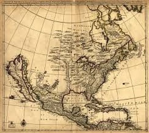
Old Map of North AmericaThis map was made before the exploration of California. It was widely believed that Baja California was an island, and much larger than it actually is. This map is clearly Spanish as they were the first European explorers in the region. As such the map likely has enlarged territory that the Spaniards controlled during the time.
As we know now Baja California isn’t a Island, but the differences continue as not many can see that modern maps also have a Baja California less than half the size it is depicted in the map. Most of the terrain is also more rounded out that current maps likely due to the less precise calculations and due to the heavy line thickness for coastlines many of the islands in the Gulf of Mexico are much larger than they actually are. |
